Get to know your soil

Photos of the 2017-2018 Agronomy in the Field cohort for Central Iowa at the ISU Field Extension Education Lab. Photos by Hanna Bates.

An education in soil sampling

Last week I attended Agronomy in the Field, led by Angie Reick-Hinz, an ISU field agronomist.  The workshop focused on soil sampling out in a field. The cohort learned a lot of valuable insight into not only the science of soil sampling, but also practical knowledge from out-in-the-field experiences.

Taking soil samples in a field is critical in making decisions about fertilizer, manure, and limestone application rates. Both over and under application can reduce profits, so the best decision a farmer can make is based on a representative sample that accurately shows differences across his/her fields.

What do you need?

  • Sample bags
  • Field map
  • Soil probe
  • Bucket

When do you sample?

After harvest or before spring/fall fertilization times. Sampling should not occur immediately after lime, fertilizer, or manure application or when soil is excessively wet.

Where do you sample?

Samples taken from a field should represent a soil area that is under the same type of field cultivation and nutrient management. According to ISU Extension, the “choice of sample areas is determined by the soils present, past management and productivity, and goals desired for field management practices.”* See ISU Extension resources for maps and examples for where in the field to take samples.

Most importantly…

Like with everything that happens out in the field, it is important to keep records on soil testing so that you can evaluate change over time and the efficiency of fertilizer programs. As we say at the Iowa Water Center, the more data, the better! The more we learn about the soils, the better we can protect and enhance them. Healthy soils stay in place in a field and promote better crop growth by keeping nutrients where they belong during rain events. Not only can we monitor soil from the ground with farmers, but with The Daily Erosion Project. These combined resources, with others, can provide the best guidance in growing the best crop and protecting natural resources.

Interested in Agronomy in the Field? Contact Angie Rieck-Hinz at amrieck@iastate.edu or 515-231-2830 to be placed on a contact list.

* Sawyer, John, Mallarino, Antonio, and Randy Killorn. 2004. Take a Good Soil Sample to Help Make Good Decisions. Iowa State University Extension PM 287. Link: https://crops.extension.iastate.edu/files/article/PM287.pdf

Capture

Hanna Bates is the Program Assistant at the Iowa Water Center. She has a MS in Sociology and Sustainable Agriculture from Iowa State University. She is also an alumna of the University of Iowa for her undergraduate degree. 

University of Iowa: A case study of flood response


In honor of construction starting soon to replace one of the last University of Iowa buildings damaged by the 2008 floods, we have decided to highlight a history of flood infrastructure investments at the university .

Just one-year shy of a decade since the 2008 floods, the final plans have been approved for a new facility for the University of Iowa Museum of Art. Like Hancher Auditorium, the music school, the library, and the Iowa Memorial Union, among about seventeen other buildings (Connerly et al 2017), the art museum was a significant loss to the university that scattered its 14,000-estimated piece collection to new locations on and off campus.

According to Connerly et al 2017, damages and recovery were estimated to be $743 million and is the highest costing disaster recovery in Iowa. As a public institution located in a floodplain area, it has had a history of flood preparation and response since its inception in 1847. As their article explains, the flooding brought up many critical questions, including: “why did the University construct important new buildings, some of them iconic, within the floodplain?” and how can the university cope with future natural and human-made flooding?

To answer the first question, the university built where they did predominantly because they had few options. The risk of flood also gave the appearance of being manageable at the time and policies for flood mitigation and subsidies were more risky than they appeared to be (Connerly et al 2017). The university started on a small four block area east of the Iowa River. The university and the City of Iowa City grew concurrently causing buildings to be placed closer and closer to the river. In 1905, the university commissioned a master plan by the Olmsted Brothers that included riverfront property, but its use would only be for recreation and parks (Connerly et al 2017). Land acquisition advisement by the Olmsteds was illustrated in the following:

“The Olmsted Brothers emphasized the need to acquire land that would be of value to the University, even if it costs more. They stated, ‘‘the process of acquisition of additional land must evidently go on indefinitely, but some other motives than those of convenience and cheapness should be kept in mind and should often have more weight than those.” (55)

The construction on the floodplain started with the Iowa Memorial Union (IMU) in the 1920s and then grew to include the arts campus. Construction for a fine arts building was originally planned for a site north of the IMU, but an agreement could not be reached for a price. Instead, the campus was developed on acquired land that was a wetland formerly used as a city landfill by the river (Connerly et al 2017).

The wetlands were filled and the buildings were constructed to be above recorded flood level data available at the time and levees were constructed on the river. Later, these efforts included the university’s support of building the Coralville Reservoir by the Army Corps of Engineers, in which the president of the university at that time stated, “the Reservoir will make possible a program for the permanent development of the river front through the University campus” ( Connerly et al 2017, p.58). The campus was growing in two halves on the east and west side of the river. Development in-between would unite the two pieces, especially when considering there were little other places to build.

This culminates in the issue of what Connerly et al (2017) describes as the “safe development paradox.” This term is used to describe the federal support for levees, dams, disaster aid programs, and other assistance that spurred development in the floodplains. By providing a safety net with federal assisted water-related control, recovery, and insurance, federal policy enabled development that came at a cost with the 1993 and 2008 floods.

How can the university cope with natural and human-made flooding for the future?

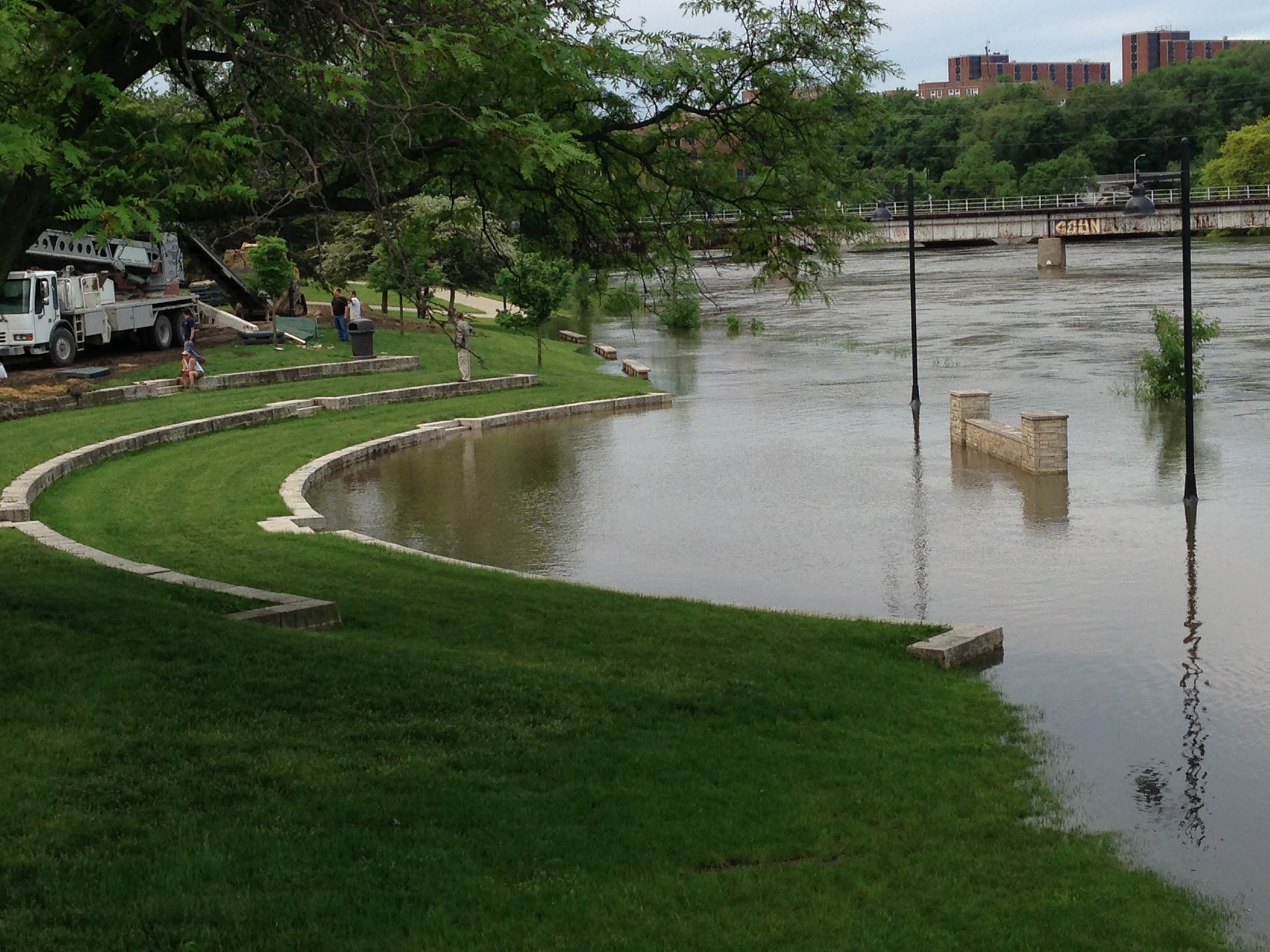
To answer this question, the university has responded to the 2008 floods by re-purposing or completely rebuilding new facilities that are more resilient to withstanding future flooding using scientific modelling as a tool. The recovery efforts include a multitude of partnerships that choreograph their work around where FEMA compliance and insurance policies reach within each building. The university voluntarily chose to conduct a campus-wide flood mitigation strategy that is in progress. This strategy includes elevated sidewalks, supports for temporary flood walls, building pumping systems, and removable external walls. The university has also rebuilt two buildings away from their original locations. As seen above, these strategies have been tested with the rise in water levels in 2013.

In review, the tumultuous history of flooding infrastructure contains valuable lessons. Resilience, which is at the core of what public infrastructure is trying to achieve, is the ability to spring back from disasters. The university that came out on the other side of the 2008 floods is one that utilizes water research and technology using scientific methods and demonstrates that there is room for improvement in state and federal policies and procedures. As a result, when future flooding occurs, we will all be better able to respond.

Connerly, Charles, Laurian, Lucie, Throgmorton, James. 2017. Planning for Floods at the University of Iowa. Journal of Planning History 16(1): 50-73.

Capture
Hanna Bates is the Program Assistant at the Iowa Water Center. She has a MS in Sociology and Sustainable Agriculture from Iowa State University. She is also an alumna of the University of Iowa for her undergraduate degree. 

Soil – Agriculture’s Reservoir

Post submitted by Hanna Bates, Program Assistant for the Iowa Water Center

The soil is like a sponge that holds water so it is available when crops need it. Wetter soil at the surface prevents deeper infiltration and so water is lost as surface runoff. Not only this, but soil moisture is also a variable that influences the timing and amount of precipitation in a given area. This is due to the impact it has on the water cycle. This cycle circulates moisture from the ground through evaporation and plant transpiration to the atmosphere and back to the ground again through precipitation. Therefore, the amount of water stored in the soil can affect the amount of precipitation received during the growing season.

esa.PNG
Satellite imaging from the European Space Agency. The center figure depicts imaging derived from SMOS.

According to Hornbuckle (2014), “we enter each growing season ‘blind’ as to whether or not there will be enough soil moisture and precipitation to support productive crops.” If there were a way to document and record water storage in the soil besides field measurements, we would have a better ability to predict future weather patterns and therefore, make better field decisions. Satellite remote sensing tools such as the European Space Agency’s Soil Moisture and Ocean Salinity (SMOS) and NASA’s Moisture Active Passive (SMAP) can be used to take such measurements. Before these tools can be used to estimate water storage and improve weather and climate predictions, researchers must compare them to what is actually measured within the soil. This process of confirming accuracy of a tool is called validation.

A project led by Dr. Brian Hornbuckle, and funded by the Iowa Water Center in 2014, sought to improve and validate SMOS and SMAP in near-surface soil moisture observations of Iowa. Hornbuckle used a network of soil moisture measurements located in the South Fork Watershed as a standard to validate the accuracy of SMOS and SMAP. At each site, soil moisture and precipitation was measured.

Some of the results of this research project are presented in a 2015 article published in the Journal of Hydrometeorology.  Rondinelli et al. found that SMOS and the network of soil moisture measurements detect different layers of the soil. SMOS takes measurements of the soil surface while the network observes a deeper level of soil. These results will allow scientists to better evaluate the accuracy of measurements from SMOS and SMAP and ultimately enhance our understanding of the water content of the soil surface.  As noted earlier, it is this layer of the soil that determines how much precipitation is lost to surface runoff.

In a subsequent study published in 2016, Hornbuckle et al. published further results that indicate new ways of using SMOS. Researchers found that SMOS can be used to look at water in vegetation, as opposed to water in the soil.  Hence SMOS might be used in the future to observe the growth and development of crops, and perhaps estimate yield and the time of harvest as opposed to conducting field surveys from the ground. It also has the potential to measure estimates of the biomass produced during the growing season, which could be useful to reach bioenergy production goals.

Research like this demonstrates that a single tool can be used in multiple ways to better understand our landscape. Not only this, but preliminary studies of SMOS also show that it is important to verify the accuracy of tools before relying on them. Like all research, the work is not done to identify all the potential uses for SMOS and SMAP.  A new NASA grant, in partnership with the Iowa Flood Center, will help get researchers even closer to making satellite measurements a useful, scientific tool to understand water near the soil surface.

References

Hornbuckle, Brian K. “New Satellites for Soil Moisture: Good for Iowans!.” A Letter from the Soil & Water Conservation Club President (2014): 20.

Hornbuckle, Brian K. Jason C. Patton, Andy VanLoocke, Andrew E. Suyker, Matthew C. Roby, Victoria A. Walker, Eswar R Iyer, Daryl E. Herzmann, and Erik A. Endacott. 2016. SMOS optical thickness changes in response to the growth and development of crops, crop management, and weather. Remote Sensing Environment (180) 320-333.

Rondinelli, Wesley J., Brian K. Hornbuckle, Jason C. Patton, Michael H. Cosh, Victoria A. Walker, Benjamin D. Carr, Sally D. Logsdon. 2015. Different Rates of Soil Drying after Rainfall Are Observed by the SMOS Satellite and the South Fork in situ Soil Moisture Network. Journal of Hydrometeorology. April 2015.


View from my Windshield: Observations of soil erosion across Iowa

For the past couple of weeks, I have been on the road across Iowa. These trips vary in their purpose, but one thing that remains the same is the evident erosion in the fields along my travels. Regardless of where I am – whether it is in the Loess Hills visiting family or in the Des Moines Lobe for a meeting – spring rains have revealed that there are deep cuts in the bare brown soils where lush, even soils used to be.

Continue reading

Get to know Alert Iowa

Alert Iowa is a statewide mass notification and emergency messaging system. The system can be used by state and local authorities to quickly disseminate emergency information to residents in counties that utilize the system. The system is available, free of charge, to all counties. Eighty-four of Iowa’s 99 counties are using the Alert Iowa system.

Continue reading

Winter Weather in Iowa

This winter, we have experienced a mix of snow, rain, sunshine, and even warm temperatures. With this variability evidenced across the state, it is important to document what we’ve evidenced so far and to anticipate the weather to come over the upcoming months. Below is a brief overview of the recent, current, and anticipated weather and water conditions for Iowa.

Continue reading